
CivicStrata
Compare neighborhoods on public data, down to a few blocks, and see who governs them. Checked in depth on Duval County, Florida.
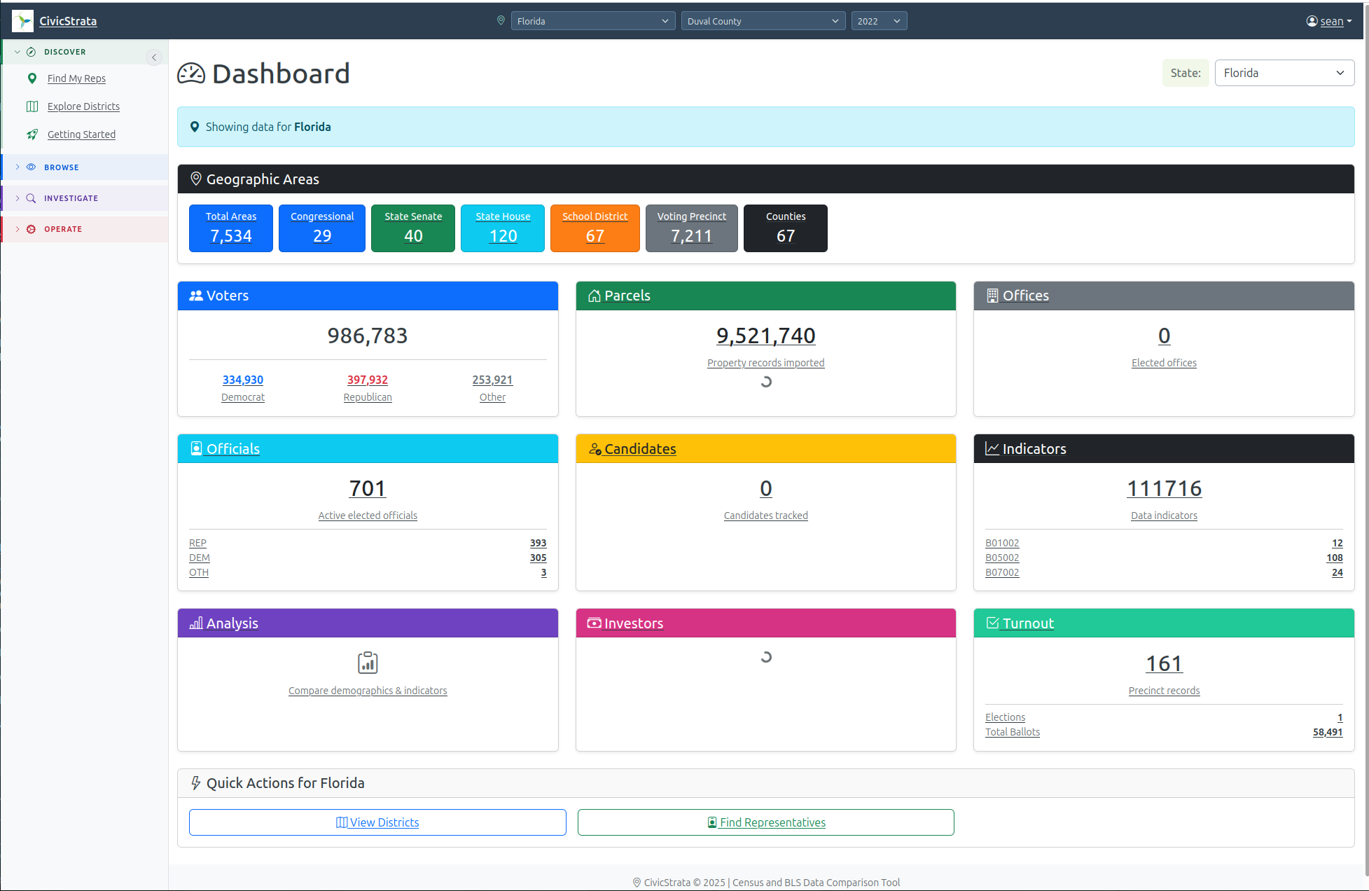
CivicStrata lines up public data on income, schooling, housing, health and voting on one map, down to a few blocks (the Census Bureau’s block group). Instead of raw numbers it ranks each area into a Q-Score: a band (a fifth or a tenth) that holds about the same number of people as every other band, so very different measures can be compared side by side. Each score is a rank, and each indicator states its own direction, so a high score is not always the good end.
Facts as of 14 November 2026. Each figure below carries its own date.
What you can do
- Rank neighborhoods. See where a block group falls among its neighbors on income, schooling and housing.
- Compare up to 20 areas in a saved “fingerprint”, as a radar chart or a table. Five areas read best.
- Brief a district. For a place, a congressional district or a county, list the block groups that differ most from the area’s median, with housing tenure and partisan lean.
- Find your representatives. On a public page that needs no login, enter an address and get every district it sits in and who represents it.
- Tell owners from renters by matching voter records to property records.
- Ask in plain English. A built-in assistant answers questions about the data.
Example questions:
- How does Atlantic Beach compare with the rest of Duval County on income, schooling and housing?
- Which block groups in Atlantic Beach are the most renter-heavy?
- Who represents this address, and which districts does it sit in?
How we know
Data sources, with scope and date (as of 14 November 2026):
| Source | What it adds | Where it covers | Vintage |
|---|---|---|---|
| Census ACS (the Census Bureau’s yearly sample survey) | income, age, schooling, housing tenure, race and more, per block group | Built and tested on Duval County, Florida (581 populated block groups). The tooling can load any state or county; ask which are loaded today | 2024 |
| BLS QCEW (jobs and wages by county) | employment and wages | loaded through an import job | annual |
| CDC PLACES | six health measures, such as diabetes, obesity and no health insurance | Duval’s 218 census tracts and Atlantic Beach | PLACES-2025 |
| EPA EJScreen | eight environmental indicators | Duval’s block groups only; EPA froze it, so it is never refreshed | 2024 |
| FEMA National Risk Index | seven measures, including composite risk and coastal, hurricane and inland flood | Duval’s 218 tracts and the county; county only for all 67 Florida counties | v1.20.0, released 2025-06-25 |
| HUD Fair Market Rents | rents by bedroom count | Duval County | fiscal year 2026 |
| Florida voter registration and vote history | who is registered, party, vote history | geocoded for Duval, St. Johns and Baker counties in the congressional district 5 pilot | monthly extract |
| Florida property parcels | owner, address, shape; tells owner-occupiers from renters | Florida | 2026 rolls |
| Districts and precincts | congressional, state, school and county boundaries | TIGER shapes and county precinct files | TIGER 2024 |
| Officials, candidates, finance | Congress, state legislators, candidate lists | campaign finance for federal candidates only | quarterly and monthly |
Voter and parcel files are Florida-only today, and the health, environment and rent layers are Duval-only.
Scale. Duval County has 581 populated block groups; Atlantic Beach is 8 of them. A September 2026 report counted 1,347,650 cached data rows, a figure that has grown since.
How figures are checked.
- An automated test locks the Q-Score output for all 581 Duval block groups (vintage 2024) against an independent recomputation.
- Every value the machine interface returns carries a citation line, a stable link and a content hash. If a number later changes, the old link says so. A value whose source is not registered is not released, and small counts under 10 are suppressed.
Known limits.
- Margins of error are not stored: 0 of the 1,347,650 cached rows had one (September 2026). At Atlantic Beach’s size, Census block-group estimates typically carry a 20 to 40% margin of error.
- CDC values are crude prevalence, not age-adjusted. EJScreen is a frozen 2024 snapshot.
- CivicStrata is non-partisan by rule: the same method for every place and every candidate. Some views, such as partisan lean, need an approved role.
Freshness. Voter files refresh monthly, Census data yearly each December, parcels yearly, election results after each certified election.
Access. The web app is open by invitation; only Find My Representatives is public. Other software can use a read-only REST interface (a key for each client, 60 requests a minute by default) or an MCP server (the standard way AI assistants call tools) with 8 read-only tools; its analysis tools need an approved role.
What you get
- The decision it supports. Where to put limited outreach, canvass or service effort inside a district: which specific blocks, not just which district. Also who represents an address and what races are on it.
- What it replaces. Hand-built spreadsheets, and stitching Census, voter-file and property-file downloads together by hand.
- Time saved. We have not measured it. Loading one county takes about 10 to 20 minutes (an estimate, September 2026).
- Price and next step. Pricing is not published yet. Request access and we will reply by email.
How it fits with the other tools
FAND measures what a county owns. CivicStrata shows who lives there and how it is governed, down to the block, so a county’s balance sheet connects to the neighborhoods inside it. Corpusminder produces topic dossiers that CivicStrata can display.
Access is by invitation during the beta — you'll sign in with the Google, Microsoft, or GitHub account we invite.